During tropical storms, rain scours the land and runoff carries sediments into the nearest sink – for Batu Puteh and the surrounding villages this is the Kinabatangan river. Overland flows deposit these sediments in depressional areas with lower elevation, sorted by turbidity, such as the floodplains bounding the river.
Tropical hardwood forests have historically covered the land, however, modern agricultural practices are altering land use and potentially altering sedimentation regimes. The oil palm industry is disturbing the land and natural nutrient regimes, and cultivators are often using fire to clear the land of trees and vines and then are depositing large quantities of fertilizers to promote high palm oil production rates and to solve the low nutrient availability of tropical soil. Changing weather patterns have altered the regularity of rainfall patterns, and changing climate regimes have left peat bog systems drier and vulnerable to fire.
Altered fire regimes have decimated local forest ecology, and the local KOPEL eco team (www.mescot.org) is working to replant the riparian forests with the help of traveling school groups such as ours and tourists eager to give back. A local restoration team has worked over the past 20+ years to create a nonprofit that has battled fires, fought back aggressive ruderal vine species that colonize all open spaces, and cultivated and replanted hardwood species.
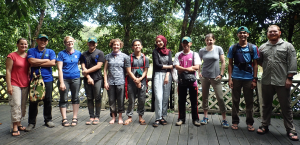
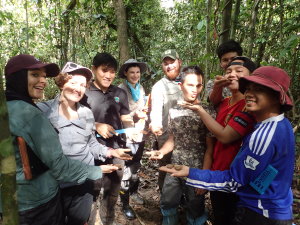
Our task was to study the tropical forests using techniques we learned in the context of our Bay Area/California Mediterranean climate and to train local staff in the methodologies. These scientific approaches could be used to transform ongoing weekly restoration projects into long-term scientific research. These skills are:
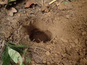
- soil monitoring, observing soil horizons at two representative points along the transect (40m and 10m):
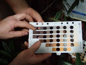
- soil pH,
- pH meter, soil probe
- temperature,
- pH meter, soil probe
- moisture,
- texture by ribbon method
- color,
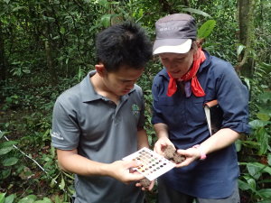
- munsell color charts
- labeled soil samples for future nitrate analysis,
- labeled GIS data points, to create soil layer maps that can be used in tandem with species maps to pinpoint soil type/species associations.
- soil pH,
Soil maps give insight: areas with different soil types have been the most challenging to try to restore, where plants have not established. Arial photographs allow staff to observe associations between soil types from the GIS maps and the photography of the vegetation types.
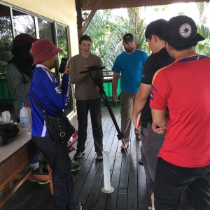
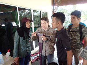
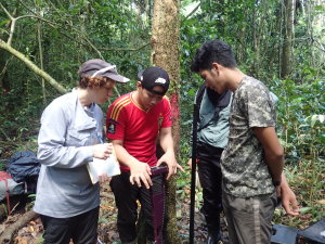
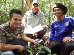
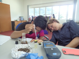
See soil monitoring photos below:
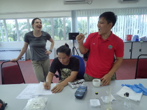
Emily demonstrates calibration technique with D.I. water while Fadwa, Amir, Phil, Fikri, and Zadie look on.
OLYMPUS DIGITAL CAMERA
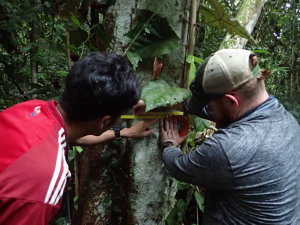
- forest monitoring for all species 1meter from the 100m transect:
- location along the transect
- two 50m transect measuring tapes
- DBH, diameter at breast height
- DBH Tape
- canopy density
- densitometer
- tree height
- inclinometer
- identifying the tree species
- location along the transect
Identifying trees to species allows researchers to demonstrate restoration success through detailed observations of forest changes. Changes in growth metrics or biomass would demonstrate recovery and success in restoration plots. Soil accretion studies could link the palm oil industry with altered landscapes, and lead to positive changes in land use in Borneo. The outcomes of this work could be used to direct future restoration plans and environmental decisions, as well as to communicate with the public and potential funders.
See forest monitoring skills, demonstrated below:
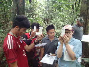
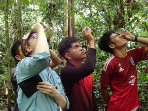
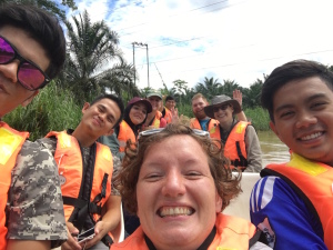
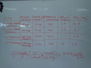
We faced many difficulties: chief among them was the weather: we anticipated we would arrive during the dry season, and be able to work on Area B of the Pin Supu forest. However, heavy rains had the river at flood levels, and research sites had more than a meter of standing water. We were able to demonstrate these skills at four different sites, one in Area B, and near Eco Camp at three sites: twenty minutes hike from the back of camp at the top of the ridge line, perpendicular to the Kinabatangan River and parallel to the wash house. On the rainiest of days we taught nitrate analysis, the photos are below.
Teaching these skills was a joyful endeavor, and I look forward to staying in touch with these new soils and silviculture professionals.